Natural Language Interaction
Describe your task in plain language and reduce the friction of traditional GIS workflows.
QueryGIS helps you interact with QGIS in plain language, generate actionable GIS steps, and accelerate spatial analysis without constant trial-and-error scripting.
Built for GIS analysts, researchers, and QGIS users who want faster, more intuitive geospatial workflows.
Product Overview
QueryGIS brings a more intuitive way to work with QGIS by letting users describe tasks in natural language instead of relying only on menus, fragmented documentation, or fragile scripts.
Describe your task in plain language and reduce the friction of traditional GIS workflows.
Turn vague ideas into concrete steps for spatial analysis, visualization, and data handling.
Cut down repetitive effort and move from intent to execution more efficiently.
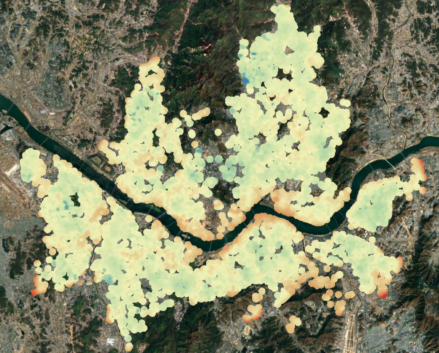
Real estate analysis workflow example
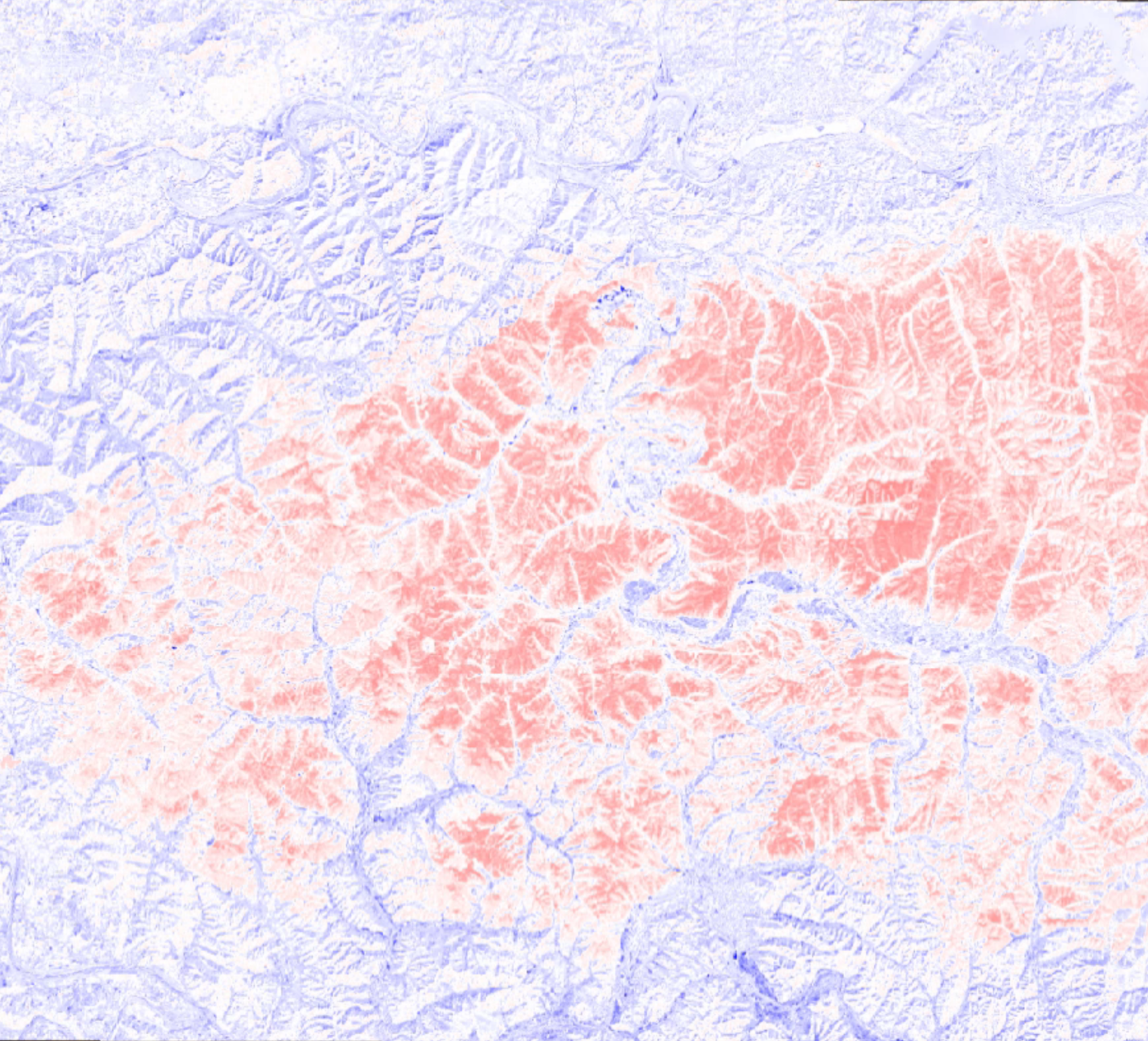
Wildfire damage analysis workflow example
Why It Matters
QGIS is powerful, but many workflows still require steep learning curves, repeated scripting effort, or too much searching through tools and documentation.
QueryGIS lowers that barrier by making geospatial work more accessible, iterative, and efficient for real project delivery.
Award and Recognition
QueryGIS was recognized in the 2025 AI Champion competition, advancing into the Top 20 among 630 participating teams and receiving the Korea Information and Communication Technology Association Award (TTA Award).
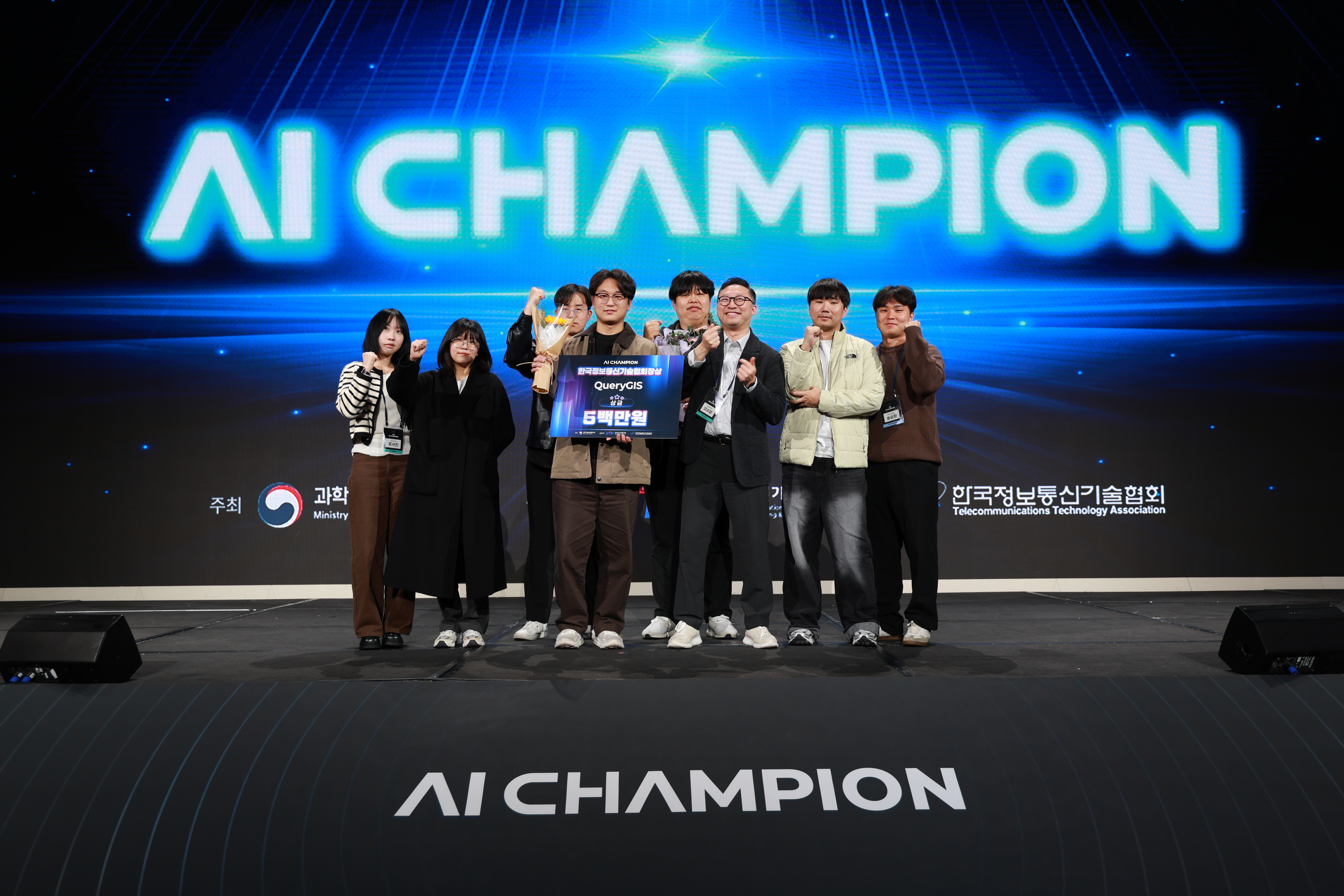
This recognition reflects both the technical ambition of QueryGIS and its practical potential as an AI-driven interface for real geospatial work.
Product Demonstration
Watch how QueryGIS helps turn user intent into practical QGIS workflows.
Use Cases
Support buffer creation, overlay logic, selection workflows, and analysis-heavy tasks with clearer execution paths.
Navigate multi-step raster operations and preprocessing workflows with fewer dead ends and less repetitive setup.
Improve maps, layer styling, and cartographic presentation with actionable direction aligned to project intent.
Reduce repetitive clicks and speed up day-to-day GIS work across teams, projects, and iterative analysis cycles.
Education and Consulting
We run practical GIS training programs with AI for spatial information institutions and universities, while also helping organizations plan and execute AI transformation in geospatial operations.
Introductory and applied courses for students, analysts, and practitioners who want to integrate AI into daily QGIS workflows.
Hands-on workshops for public organizations and academic teams focused on real datasets, repeatable exercises, and operational adoption.
Advisory support for roadmap design, workflow diagnosis, and implementation planning to accelerate practical AI conversion in geospatial teams.
Product Philosophy
QueryGIS is not just about adding AI to QGIS. It is about improving how users move from intention to execution, with practical guidance that fits real workflows and real delivery constraints.
Explore an award-recognized AI interface purpose-built for serious QGIS users who need reliable workflow acceleration.